
its landmass, boundaries, waterways and offshore assets — is not just a matter of geography. It is a matter of sovereignty, planning and national development. Yet the federal office charged with defining and safeguarding that geospatial identity is battling shrinking manpower, funding gaps and stalled capital releases.
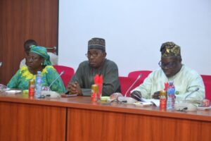
When the Office of the Surveyor-General of the Federation (OSGoF) appeared before the Senate Committee on Federal Character and Employment chaired by Allwell Heacho Onyesoh, the conversation quickly shifted from maps and coordinates to vacancies, unpaid obligations and budget inconsistencies.
At the centre of the presentation was the Surveyor-General of the Federation, Abdulganiyu Adebomehin, who painted a picture of an agency stretched thin.Once boasting over 900 personnel, the office now operates with 540 staff — a sharp decline driven largely by mass retirements and the absence of recruitment waivers.
In some state offices, Adebomehin admitted, only one or two officers remain on ground.The implications are significant. The OSGoF maintains survey units in multiple ministries and across all 36 states, providing technical oversight for mapping, boundary demarcation and infrastructure monitoring. A diminished workforce means increased operational strain, higher deployment costs and delayed project timelines. Adding to the complexity, some staff members are yet to be captured under the Integrated Payroll and Personnel Information System (IPPIS), creating salary gaps and administrative bottlenecks.
Funding figures tell an equally troubling story. While personnel and overhead allocations in 2024 were fully released, only 86 per cent of capital funds were disbursed. In 2025, no capital allocation had been released at the time of presentation. For an agency whose mandate depends heavily on technology, from photogrammetry to remote sensing and unmanned aerial vehicles, capital funding is not optional. It determines the ability to upgrade equipment, conduct nationwide mapping at modern scales and monitor critical infrastructure. Lawmakers questioned inconsistencies in personnel allocations, particularly why the 2026 personnel proposal appears lower despite acknowledged shortfalls in previous years.The agency attributed the fluctuations to retirements and structural payroll adjustments, but the exchange underscored deeper structural funding concerns.
Beyond the numbers lies a strategic national function. The OSGoF defines Nigeria’s spatial boundaries — the length and breadth of the country, its coastal waters and maritime extents — and provides geospatial data essential for urban planning, security operations, disaster response, dam assessments and bridge monitoring. The agency reported conducting large-scale mapping at a 1:5,000 scale in line with updated international standards, as well as monitoring major infrastructure including the Second Niger Bridge and key dams and highways.In an era where data drives economic growth, climate resilience and security coordination, geospatial intelligence is foundational. Without updated maps and boundary clarity, land administration disputes multiply, infrastructure projects face inaccuracies and national planning loses precision.What emerged from the Senate engagement was not merely a technical budget defence but a broader governance question: can Nigeria afford to underfund the very institution that defines its territorial reality?
The Committee acknowledged the specialised and highly technical nature of the office’s work, noting that its operations require expertise not easily replaced. Yet the agency must now navigate declining manpower and uncertain capital releases while maintaining nationwide responsibilities.As deliberations on the 2026 budget continue, the fate of the OSGoF may serve as a quiet indicator of how seriously the country treats its geospatial backbone. For an agency that literally maps the nation, the challenge now is navigating its own uncertain terrain.


